36 of 48
4100 feet
The drive in to Franconia Notch State Park was pretty awesome and surreal! The day was really sunny and the foliage got progressively better as I drove north. However, as I got closer to the Notch, I noticed that there was a thick gray cloud sheet over the entire area. This was actually kind of neat, as the foliage colors were sandwiched by the gray sky and the slate color of the cliffs on the side of Cannon and... Lafayette (? on the right).

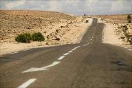
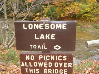
The trailhead started at Lafayette Campground (getting there required me to switch directions on 93), and started out by crossing a cool bridge. It had rained a TON the past couple days, and I was surprised that the water wasn't higher.
So I decided to reach the summit via the Hi-Cannon trail, which, it turns out, isn't quite as popular as the Lonesome Lake trail. In fact, of all the dozens of people that were behind and in front of me at first, I was the only one who took the Hi-Cannon trail when it split off.

Most of the first half of the trail was wooded and close enough to 93 where I could constantly hear traffic. It was also extremely steep, even with the constant switchbacks (seriously, the whole way up this section was switchbacks).
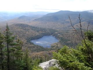
Eventually, the trail opened up and went along a nice open ridge (from which I could see my stupid car) and eventually gave a nice view of Lonesome Lake. To see a lake stuck in the mountains like that is great, especially since you would never suspect it was there from the highway if you didn't know about it.
Also awesome was this ladder that is actually a lot bigger than this picture makes it out to be. It's the first time I've seen anything like this on a hike.
After this, the trail went back into the woods and got a lot narrower and a lot wetter. It was also a lot less steep.
Eventually, I got stuck behind a group of people who were pretty much oblivious to the fact that I was going about twice as fast as them (the trail was too narrow for me to pass them). One older guy noticed me but he was too busy explaining some weird pretentious shit to a younger woman to realize that I wanted to pass. The guy actually looked me in the eye after I said, "excuse me," and he ignored me and kept talking and walking slow. I eventually plowed past them all the first chance I got, and one or two of them stepped back into a deep puddle. Heh.
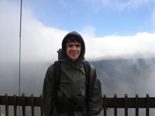
Sooo anyway, the Hi-Cannon trail ended soon after this and joined the Kinsman Ridge trail on its way to the summit. Right around this point I entered the clouds and it became pretty cold. The summit and observation tower was another 5-10 minutes, and by that time it had to have been around 30°. The wind up on the tower was absolutely insane... I felt like I could blow over. I asked some guy to take my picture and he sort of freaked out because he was so cold and wanted to get off the tower. He still took it though.

Also neat was the fact that it was sunny everywhere except for where I was. This meant that I could occasionally look out of the cloud to sunny trees far below. After, I wandered over to the cafeteria and tram. I was pretty tempted to sit down for a meal and take the tram down, but I decided that it would be sort of... cheating.
Overall, probably one of the more enjoyable hikes I've done, and it's my first new 4,000 footer in 6 years and 362 days (2 days short of 7 years).


